


Trimble Outdoors Navigator Pro

Trimble Outdoors Navigator Pro의 설명
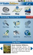
Change the way you explore. Trimble Outdoors Navigator is a GPS navigation and mapping app for all your outdoor and backcountry adventures. View more than 68,000 topo maps in US and Canada, as well as aerial, terrain, street and hybrid maps. Mark waypoints, capture photos and video and store all your trip info on the Trip Cloud, a wireless service that allows you to access your trips on any device.
This app is BEST FOR: GPS route finding; map and compass navigation; offline topo maps; recording trips like hiking, camping, paddling, ATV riding, offroading, backcountry skiing, snowshoeing
------
** START WITH GREAT MAPS **
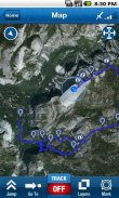
• View five different map types: streets, hybrid, aerial, topo and terrain.
• Take your maps anywhere. Save maps on your Android for offline viewing in far-flung places without the need of a cellular or data signal. Just preview the maps you want before you leave for the trip.
• Get exclusive and enhanced topo maps from MyTopo. Access more than 68,000 topo maps in US and Canada that are seamlessly stitched together for fast and easy viewing. Topos scales are 1:24K in the Lower 48, 1:63K in Alaska and 1:50K in Canada.
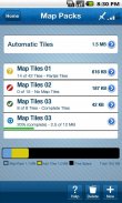
• Create map packs to store maps on your phone. This app allows you to save topos (MyTopo), aerials (Bing), streets (OSM), and terrain (OCM) map types on your phone.
• Get worldwide aerial images on your Android phone. Our app gives you rare access to view and store offine aerial imagery from Bing maps.
• NEW: Plug in statewide topo maps into your Android with our new SD cards. Learn more at:http://www.trimbleoutdoors.com/SDCards/** POWERFUL NAVIGATION TOOLS **
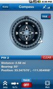
Digital Compass: Navigate with digital compass. Choose between: Magnetic North and True North.
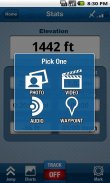
Waypoints: Mark waypoints like trailheads, summits, important turns, and campsites on to the map. Add names and detailed descriptions. Be an expert backcountry navigator by going to a previous marked waypoints too.
Tracks: Track your route on the map.
Goto: Use the Goto feature to navigate from your current location to a waypoint.
Coordinates: Match your latitude/longitude or UTM coordinates to your paper map or GPS device. Supported map datum: WGS84 and NAD27.
Guide Trips: Use trips previously recorded by you or others to help guide you on the trail, on remote backroads, and more.
** CHRONICLE YOUR ADVENTURE **
Capture Media: Take geo-tagged photos, videos and audio clips of your trip
Stat Tracking: See 10+ adventure stats, such as distance, speed, elevation and more
Share with Friends: Share your adventure on Facebook, Twitter, YouTube and TrimbleOutdoors.com
Trips: Access to thousands trips around the U.S. and Canada
** SAVE TO THE TRIP CLOUD **
Register a free account to save your outdoor trips to our Trip Cloud. Benefits include:
• Store and backup unlimited trips. Never lose files again.
• Auto-sync trips between your computer, Android and iPad.
• Enhance trips from Trimble Outdoors Navigator with map tools at trimbleoutdoors.com, including .gpx import, geo-tagged photos and videos, turn-by-turn routes and more. (requires membership)
• Open trips in our iPad trip-planning app, Trimble Outdoors MyTopo Maps.
• Share and exchange trips with the Trimble Outdoors community or privately between outdoor friends.
** LEARN MORE **
Visit our website and check out thousands of trips submitted by the Trimble Outdoors community. Click over to: trimbleoutdoors.com.
Feedback Wanted: Found a bug? Want a new feature? Drop us a line on our Facebook page, facebook.com/trimbleoutdoors.
-----
Note: Trimble Outdoors Navigator is designed for Android phones, not tablets. Continued use of GPS running in the background can dramatically decrease battery life.당신이 탐구 방법을 변경합니다. 트림 블 야외 네비게이터 GPS 네비게이션 및 아웃 도어 오지 모험 모든 매핑 응용 프로그램입니다. 이상 68,000 TOPO 미국과 캐나다의지도뿐만 아니라, 공중, 지형, 거리 및 하이브리드지도를 볼 수 있습니다. 마크 웨이 포인트는, 사진 및 비디오를 캡처 및 여행 클라우드, 당신은 어떤 장치에서 여행을 액세스 할 수있는 무선 서비스의 모든 여행 정보를 저장합니다.
이 응용 프로그램에 가장 적합합니다 : GPS 경로 발견,지도와 나침반 탐색, 오프라인 TOPO지도, 얕은 하이킹과 같은 기록 여행, 캠핑, ATV 타기, offroading, 오지 스키, 스노우 슈잉
------
* ** GREAT MAPS으로 시작
• 다섯 가지지도 유형보기 거리, 하이브리드, 항공, 갖다 및 지형.
• 어디서든지도를 가져 가라. 휴대폰이나 데이터 신호의 필요없이 멀리 떨어진 곳에서 오프라인으로 볼 수 안드로이드에지도를 저장합니다. 당신이 여행을 떠나기 전에 당신이 원하는 맵을 미리 볼 수 있습니다.
• MyTopo에서 독점 및 향상된 갖다 맵을 가져옵니다. 완벽 빠르고 쉽게 볼 수 스티칭되어 미국과 캐나다에서 이상 68,000 TOPO지도에 액세스 할 수 있습니다. TOPOS 비늘 48 로여 1시 24분 K, 알래스카 1:63 K과 캐나다에서 1시 50분 K입니다.
• 휴대 전화에지도를 저장하는지도 팩을 만듭니다. 이 응용 프로그램은 당신이 (MyTopo) TOPOS을 저장할 수 있으며, 안테나 (빙), 거리 (OSM), 그리고 귀하의 휴대 전화에서 지형 (OCM)지도 유형.
• 당신의 안드로이드 전화에 전세계 항공 이미지를 가져옵니다. 우리의 애플 리케이션은 당신에게 빙지도에서 offine 항공 사진을보고 저장하는 희귀 한 액세스를 제공합니다.
• NEW : 우리의 새로운 SD 카드와 안드로이드로 전국 TOPO지도를 연결합니다. 에서 자세한 내용을 보려면 :http://www.trimbleoutdoors.com/SDCards/* 강력한 탐색 도구 **
디지털 방식으로 나침의 : 디지털 나침반 이동합니다. 자북과 진북 : 사이에 선택합니다.
중간 : trailheads, 정상 회담, 중요한 회전 및 맵에 야영장과 같은 마크 중간. 이름과 자세한 설명을 추가합니다. 도 이전에 표시된 웨이 포인트로 이동하여 전문가의 오지 네비게이터합니다.
트랙 :지도에 경로를 추적 할 수 있습니다.
고토 : 현재 위치에서 웨이 포인트로 이동 고토 기능을 사용합니다.
위치 : 당신의 종이지도 나 GPS 장치에 위도 / 경도 또는 UTM 좌표를 일치시킵니다. 지원되는지도 데이텀 : WGS84 및 NAD27.
가이드 여행 : 이전에 원격 뒷길에 흔적에 당신을 안내하는 데 도움이 당신이나 다른 사람에 의해 기록 사용 여행, 그리고 더.
* 모험 ** 크로니클
미디어 캡처 : 지리적 태그 사진, 동영상, 여행의 오디오 클립을 가지고
합계 추적 : 같은 거리, 속도, 고도 등과 같은 10 + 모험 통계를 참조하십시오
친구와 공유 : 페이스 북, 트위터, 유튜브 TrimbleOutdoors.com에 모험을 공유
여행 : 미국 및 캐나다의 주위에 수천 여행에 대한 액세스
* ** TRIP 클라우드에 저장
우리의 여행 클라우드에 야외 여행을 저장하는 무료 계정을 등록합니다. 이점은 다음과 같습니다 :
• 저장 및 백업 무제한 여행. 다시 파일을 손실하지 마십시오.
• 자동 동기화 컴퓨터, 안드로이드 및 iPad 사이의 여행.
•. GPX 수입, 지리적 태그 사진과 동영상, 턴 바이 턴 경로 등을 포함한 trimbleoutdoors.com의지도 도구와 트림 블 야외 네비게이터에서 여행을 향상시킬 수 있습니다. 사용 (회원)
• 열린 우리의 iPad 여행 - 계획 응용 프로그램, 트림 블 야외 MyTopo지도에 여행.
• 공유 및 교환 실외 친구 사이는 Trimble 야외 사회 또는 개인에 여행.
* 자세히 알아보기 **
우리의 웹 사이트를 방문하고는 Trimble 야외 커뮤니티에 의해 제출 된 여행의 수천을하세요. trimbleoutdoors.com :에 이상을 클릭합니다.
의견 구함 : 버그를 발견? 새로운 기능을 원하십니까? 우리에게 우리의 페이 스북 페이지에 라인을 드롭 facebook.com / trimbleoutdoors.
-----
참고 : 트림 블 야외 탐색기는 안드로이드 폰이 아닌 태블릿을 위해 디자인된다. 백그라운드에서 실행 GPS의 지속적인 사용은 극적으로 배터리 수명을 줄일 수 있습니다.


